
History
It is widely believed that the name Cronton derives from the Saxon name ‘Crawenton’
meaning ‘Settlement of Crows.’ However, the name is more likely to derive from Old English
terms Crhõ +ing + tun, meaning ‘farmstead at the place with a nook.’ The ‘nook’ could refer
to the settlement’s location in relation to Pex Hill. The community appears as a small village
in the Norman landholdings document the Testa de Nevill and is also mentioned in the
Domesday Book of 1066 as part of the hundred of Warrington, which was later known as
the West Derby Hundred that covered most of south west Lancashire.
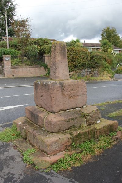
The ‘Town End’ name of this part of Cronton relates to its location at the edge of the cluster
of farmsteads that made up the community. ‘Town’ in this sense is any small cluster of
buildings rather than our modern-day meaning of the word. The presence of both the Hall
and ancient cross in Town End, and the survival of buildings from earlier periods suggest it is
older than the ‘Cronton’ settlement which was originally concentrated further south,
around the Cronton crossroads. In the 12th century the township was in control of
Matthew, son of William. In 1250 it was given by Edmund de Lacy to Stanlaw Abbey as alms.
The abbot of Stanlaw is later recorded as being involved in boundary disputes in the
fourteenth century. There is also archaeological evidence to suggest that open field
agriculture had been practised in this area at this time. The Abbey retained ownership until
the dissolution of the monasteries in 1537 when the manor (which included the Hall and
tenant farms) was held by the Crown and was later sold to Thomas Holt of Gristlehurst.
When the Holts’ ownership of the manor ceased in 1587 the manor was described as
containing 20 messuages (houses or cottages with associated land), two mills and 500 acres
of land. For over a century the lands passed through a succession of owners until the mid17th
century when it came into ownership of the Wright family who were to be long term
holders of the manor.
Their impact on the area survives in the name of Wrights Lane that runs past the Hall and
towards Rainhill Stoops, and Wrights Farm on Hall Lane. Successive generations of the
family lived at Cronton Hall until 1821 when it was again sold, this time to Mr Bartholomew
Bretherton of Rainhill who enlarged the house and grounds. The property remains standing
and is undoubtedly the most dominant structure in the whole conservation area. The Hall
dates from the early 18th century and boasts a set of imposing wrought iron gates. These
have been Grade II listed since 1952.
Town End’s distinctly rural setting survived until the mid-twentieth century when mass
housing enveloped the southern and eastern sides of Town End. Maps from the 1960s show
several housing estates appear on previously undeveloped land and the introduction of new
residential zones such as The Ridgeway, Iver Close, Hampton Drive, Malton Close and
others. Most noticeably previously vacant land to the west of Cronton Hall now features a
number of raised bungalows set back from the main road, along with parking bays.
Pex Hill overlooks the conservation area and also has a long history. The area was recorded
as common land in the 13th century and during the years of the plague was home to a
number of wooden cabins. These were built for infected victims to live out their final days
away from the rest of society. The quarry near here appears to have fallen out of use in the
second half of the 19th century, perhaps when a series of reservoirs were established on the
other side of the hill.
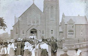
Opening of Holy Family Church